paulhammond5155

joined 2 years ago
 

Credits: NASA/JPL-Caltech/UofA


Another day, another drive for Perseverance rover. This short drive was completed during mission sol 1463 (April 1, 2025) to site number 71.160. Attached is one of the tiled end-of-drive left NavCam image. Credits: NASA/JPL-Caltech

[–] [email protected] 2 points 2 days ago

I'm just as guilty, I also missed it when I went through the abstracts. It was posted by one of the amateur mappers over on UMSF Discord :) Back in the day when I used to post to FB I maintained a reference FB-Note, but FB decided they did not need notes anymore and it was lost. Not long back I quit FB when they started playing silly games. I'm currently in the middle of removing all my connections to Google, but if you're still using Google I can point you to a maintained traverse map of MSL that's is integrated into Google Earth. The guy who does it posts updates every few drives and he includes all the notional paths. He even has links to higher res map tiles that can be integrated into Google Earth Pro (the free version). Let me know if you're interested


NASA’s Mars rover Curiosity acquired this image of the upcoming “boxwork” structures to its west, using its Chemistry & Camera (ChemCam) Remote Micro-Imager (RMI). The ChemCam instrument studies the chemical composition of rocks and soil, using a laser to vaporize materials, then analyze their elemental composition using an on-board spectrograph. The ChemCam RMI is a high-resolution camera atop the rover’s mast. Curiosity captured this image on March 27, 2025 — Sol 4493, or Martian day 4,493 of the Mars Science Laboratory mission — at 15:35:21 UTC. NASA/JPL-Caltech/LANL

Written by Natalie Moore, Mission Operations Specialist at Malin Space Science Systems

Earth planning date: Friday, March 28, 2025

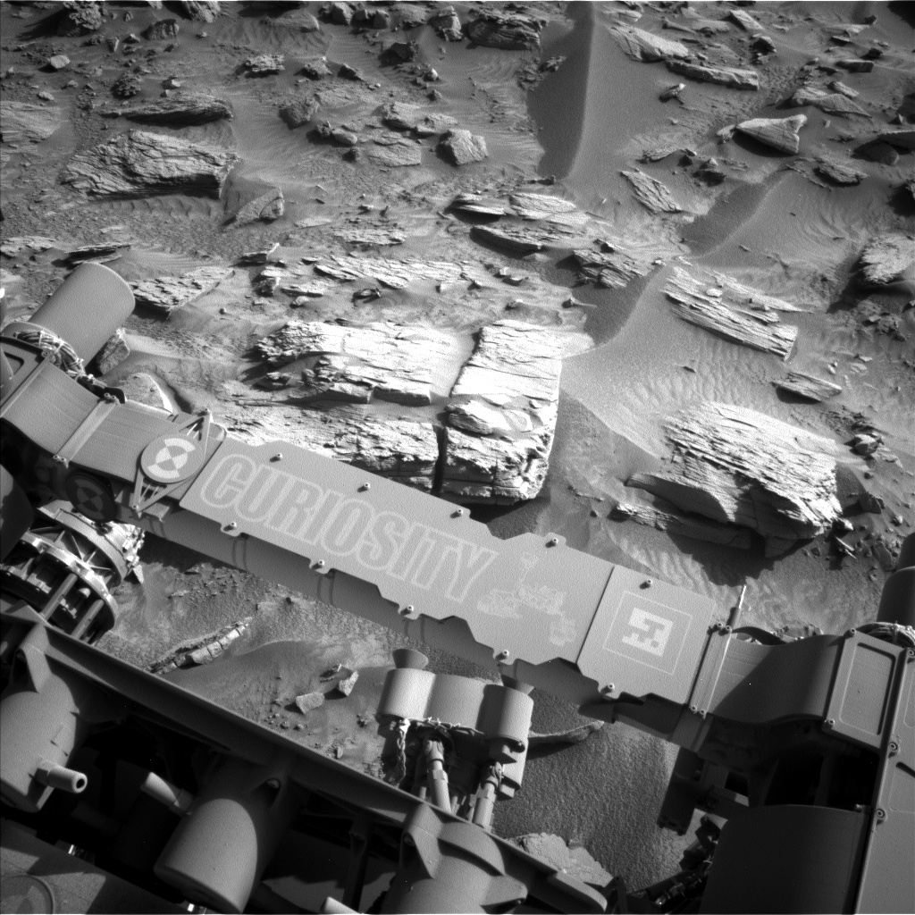
Womp, womp. Another SRAP (Slip Risk Assessment Process) issue due to wheels being perched on these massive layered sulfate rocks. With our winter power constraints as tight as they are, though, keeping the arm stowed freed up more time to check some lines off our rover’s weekend list. To do: SAM activity to exercise Oven 2 (check!), Navcam 360-degree “phase function” sky movie to monitor scattering of Martian clouds (check!), APXS atmospheric measurements of argon (check!), ChemCam passive sky measurements of oxygen (check!), and a drive of about 50 meters (about 164 feet) to the southwest (check!). Curiosity gets busy on the weekends so us PULs can do some lounging.

On the Mastcam team, we've been pretty busy in the layered sulfate unit. The rocks are rippled, layered, fractured, and surrounded by sandy troughs. Where did it all come from? What current and past processes are at play in this area? This weekend we're collecting 70 images to help figure that out. ChemCam is helping by collecting chemistry measurements of the lowest block in this Navcam image, with two targets close by aptly named “Solana Beach” and “Del Mar.” To help conserve power, we’ve been trying to parallelize our activities as much as possible. Recently this means Mastcam has been taking images while ChemCam undergoes “TEC Cooling” to get as cold as possible before using their laser.

We’re all hoping the arm can come back from vacation next week.


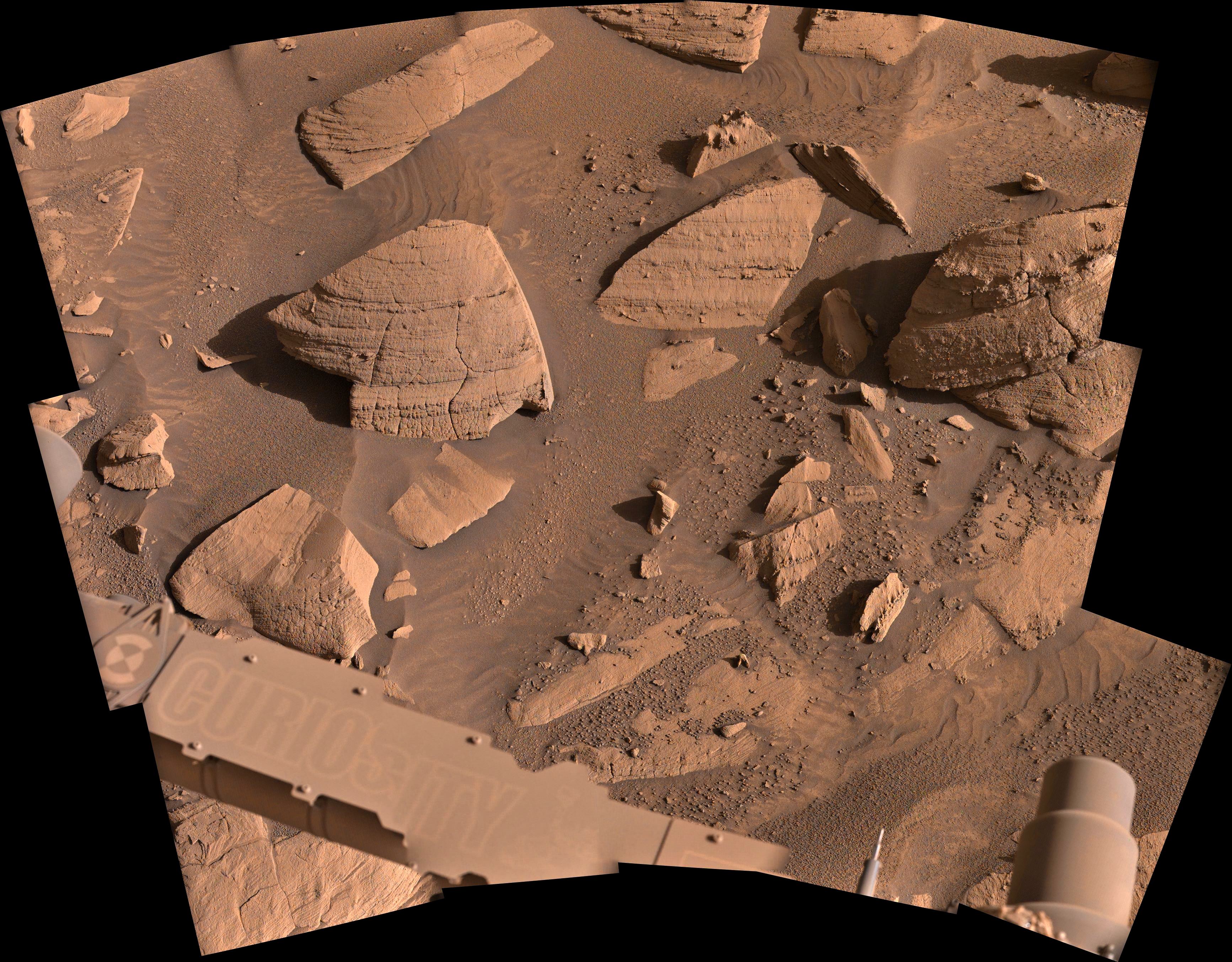
Sol 4496 L-MastCam mosaic using 15 Bayer reconstructed images NASA/JPL-Caltech/fredk


Credit: NASA/JPL-Caltech/UofA


Site 71.120 - 4-tile NavCam - NASA/JPL-Caltech

[–] [email protected] 3 points 3 days ago

They could spend months investigating just the stuff you could throw a stone at from here, but I guess they'll pack up soon and head away?


This photo was selected by public vote and featured as "Image of the Week" for Week 215 (March 23 - 29, 2025) of the Perseverance rover mission on Mars.

NASA's Mars Perseverance rover acquired this image using its Left Mastcam-Z camera. Mastcam-Z is a pair of cameras located high on the rover's mast.

This image was acquired on March 27, 2025 (Sol 1458) at the local mean solar time of 11:52:53.

Image Credit: NASA/JPL-Caltech/ASU


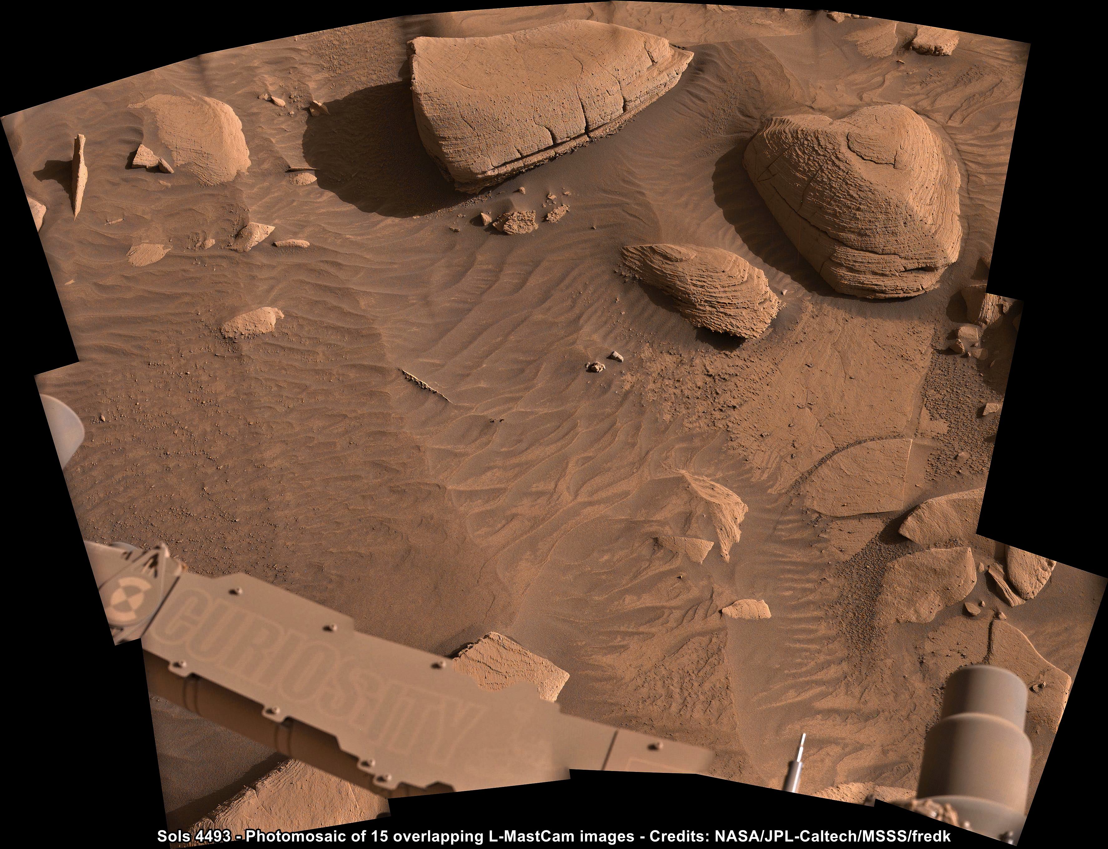
NASA/JPL-Caltech/MSSS/fredk

[–] [email protected] 3 points 5 days ago

There are a few places that come close (Desert areas), but no exact matches. Here are a few that come close

https://www.bbcearth.com/news/the-places-where-you-can-visit-mars-on-earth

[–] [email protected] 4 points 6 days ago

I used to own a small collection of pebbles that I'd gathered on my travels, each triggered fond memories of places visited. But all were left at my old place when I moved. For whatever reason I failed to start a new collection since moving. You're right, I am drawn to the polished cobbles, some of them remind me of desert varnish. However if I could only pick one to place on my desk, then it would have be one of the small iron meteorites that have been spotted by the rovers. There are some nice SuperCam's of this target, but my poor processing skills of those raw images don't add any value

[–] [email protected] 3 points 1 week ago

It's almost like the DSN is teasing us :)

Can't wait to see the close-ups :)

[–] [email protected] 2 points 2 weeks ago

Image credits: NASA/JPL-Caltech/MSSS/fredk/UofA

[–] [email protected] 3 points 2 weeks ago

We can see the featured outcrop in the sol 4480 workspace L-MastCam mosaic posted a few days ago on this community. (just right of image center)

https://lemmy.world/pictrs/image/6edf70f9-930b-4d36-ad35-128bc75ce61f.jpeg

[–] [email protected] 2 points 2 weeks ago

I wanna play in the Martian sand too!!!

Here's the best section of sand in Gale crater, these were imaged over 9 years ago.

[–] [email protected] 2 points 2 weeks ago

Wild for sure, and now they have driven away with that empty tube.... Hard to understand what's going on

[–] [email protected] 4 points 2 weeks ago (2 children)

It was but a short time later it is missing from the tube when imaged again with the same camera, and it was also seen to be missing from the tube when it was imaged inside the rover at the sample measuring station by CacheCam a short time later.

It's a probably a delay rather than a problem, as the images we have so far shows they did not cap / seal the empty tube. Empty tubes that have not been capped can be reused many times providing they are not damaged, and this one was apparently not damaged, they just lost the fractured core.

I guess we'll see them try again to obtain a core at this same location, or move on to a less fractured piece of bedrock that may not break up so easily.

Watch this space :)

[–] [email protected] 3 points 3 weeks ago

Looking at the CacheCam, it appears to be another short core.

We'll have to wait for the official length when the update the sample page, but it looks fairly deep in the sample tube.

view more: next ›