
1

Rules:
1.. Please mark original photos with [OC] in the title if you're the photographer
2..Pictures containing a politician from any country or planet are prohibited, this is a community voted on rule.
3.. Image must be a photograph, no AI or digital art.
4.. No NSFW/Cosplay/Spam/Trolling images.
5.. Be civil. No racism or bigotry.
Photo of the Week Rule(s):
1.. On Fridays, the most upvoted original, marked [OC], photo posted between Friday and Thursday will be the next week's banner and featured photo.
2.. The weekly photos will be saved for an end of the year run off.
Instance-wide rules always apply. https://mastodon.world/about
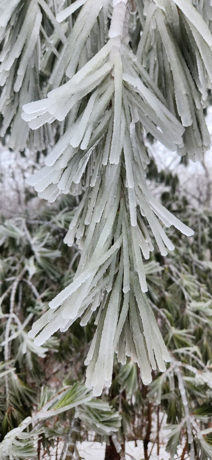
Here are their scatterings. 
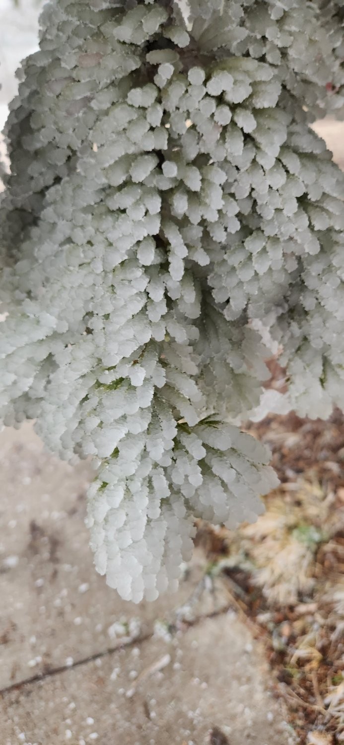
And another one...

Humayun's tomb is the tomb of the Mughal emperor Humayun, located in Delhi, India. The tomb was commissioned by Bega Begum, Humayun's first wife and chief consort, in 1558, and was designed by Mirak Mirza Ghiyas and his son Sayyid Muhammad, Persian architects chosen by Bega. Inspired by Persian architecture, it was the first Indian building to use the Persian double dome on a high neck drum, the dome being white in colour. The rest of the building is largely red sandstone, with white and black marble and yellow sandstone detailing. It reaches a height of 47 metres (154 ft) with a plinth 91 metres (299 ft) wide. A cenotaph is situated directly underneath the dome, while Humayun's actual burial place is in an underground chamber below that. The tomb is a UNESCO World Heritage Site, and several smaller monuments and other tombs are located nearby. This photograph shows the western facade of Humayun's tomb as seen in 2012.
Photographer: Muhammad Mahdi Karim

Today is Holi, the festival of colors. it is the time when friends come together and all the differences throughout the year sink in the colors of holi. Bangladesh is a country where the Hindus are a minority community. But as it is a land of multicultural diaspora, the hindus celebrate holi with a riot of colors and they embrace their muslim brothers with the extravagant colors of holi. it is the time when all disputes are forgotten in the myriads of gulal or colored powders, with which holi is celebrated. the folklore about holi is that, lord krishna played holi with his divine fiance radha and her friends. thus friendship is the fervor of this auspicious festival, and holi is the time when the spirit of camaraderie overpowers all evil forces.
Photographer: Md Rafayat Haque Khan

Apollo 9 (March 3–13, 1969) was the third crewed mission in the United States' Apollo program. Launched by a Saturn V and flown in low Earth orbit, the mission flight-qualified the Lunar Module, showing that its crew could fly it independently, then rendezvous and dock, as would be required for Apollo 11, the first crewed lunar landing. Commander James McDivitt, Command Module Pilot David Scott, and Lunar Module Pilot Rusty Schweickart tested systems and procedures critical to landing on the Moon. A spacewalk tested the extravehicular life support backpack. McDivitt and Schweickart, entering the Lunar Module through the docking tunnel, became the first humans to pass between spacecraft without going outside them, two months after Soviet cosmonauts spacewalked to transfer between Soyuz 4 and Soyuz 5. Apollo 9, a complete success, was followed by Apollo 10, the dress rehearsal for Apollo 11. This photograph shows Schweickart operating a Hasselblad camera on the porch of the Lunar Module during an extravehicular activity on the fourth day of the Apollo 9 mission. The image was taken by Scott while standing in the hatch of the Command Module Gumdrop.
Photographer: David Scott

cross-posted from: https://aussie.zone/post/30261135
Sharpless 249 and the Jellyfish Nebula
Image Credit & Copyright: Katelyn BeecroftExplanation: Normally faint and elusive, the Jellyfish Nebula is caught in this alluring telescopic field of view. Floating in the interstellar sea, the nebula is anchored right and left by two bright stars, Mu and Eta Geminorum, at the foot of the celestial twins. The Jellyfish Nebula itself is right of center, seen as a brighter arcing ridge of emission with dangling tentacles. In fact, this cosmic jellyfish is part of bubble-shaped supernova remnant IC 443, the expanding debris cloud from a massive star that exploded. Light from the explosion first reached planet Earth over 30,000 years ago. Like its cousin in astrophysical waters the Crab Nebula supernova remnant, the Jellyfish Nebula is known to harbor a neutron star, the ultradense remnant of the collapsed stellar core. An emission nebula cataloged as Sharpless 249 fills the field at the upper left. The Jellyfish Nebula is about 5,000 light-years away. At that distance, this image would be about 300 light-years across.

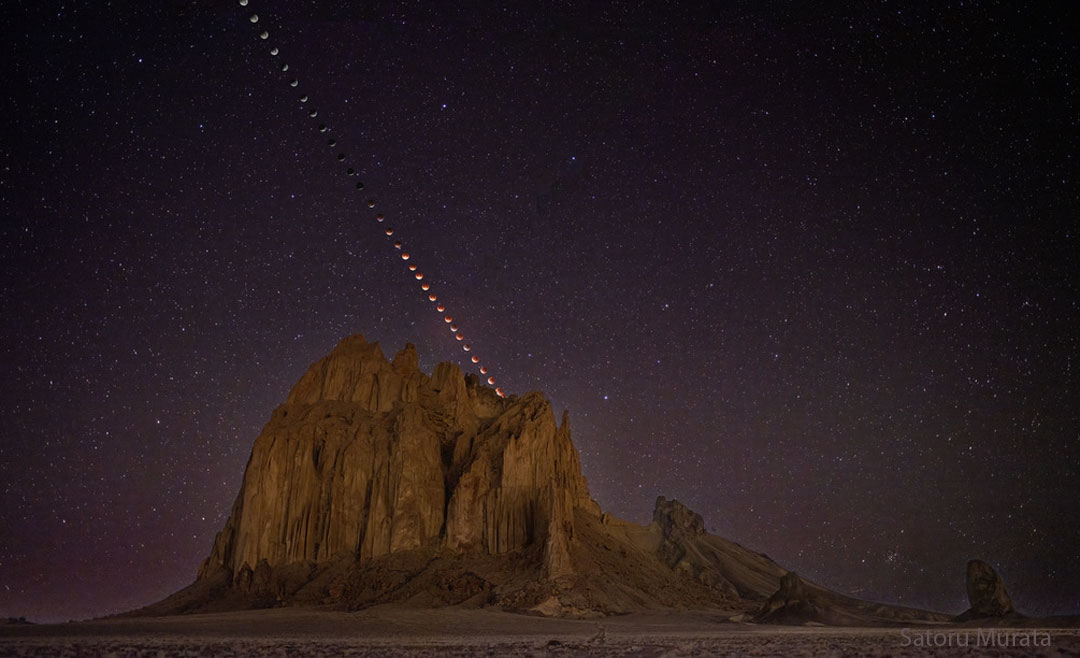
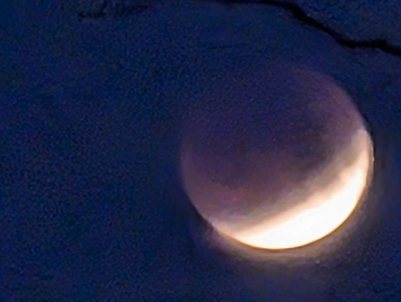
Blood moon
The lunar eclipse at its peak, as seen from Brisbane/Meanjin, Australia.
1 second handheld exposure on an OM-1 Mk II / M.Zuiko Digital ED 300mm F4.0 IS PRO, so it's not quite as crisp as I would have liked.
Post processing done in Darktable

Was headed home when the whole city lost power. Even the traffic lights were out. Pulled I to a parking lot to wait for the bad drivers to clear.

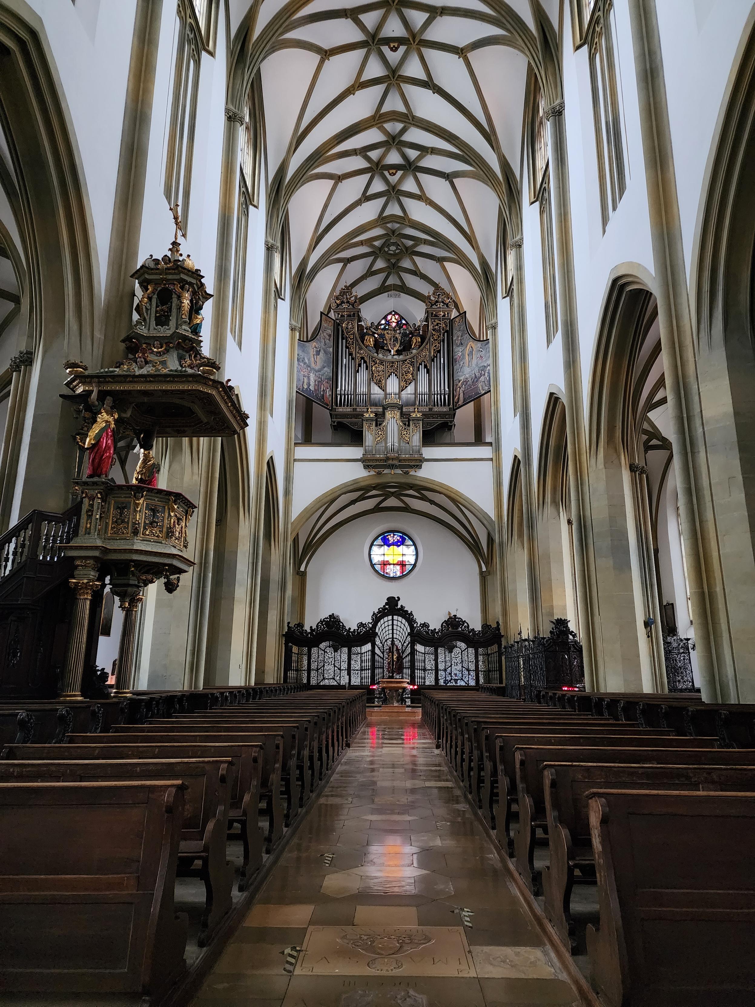
Basilica of SS. Ulrich and Afra, Augsburg, Germany [OC]
#Germany #Christianity #ChurchArchitecture #ArchitecturePhotography #ArchitecturalHistory #architectuur #arkitektur #SmartphonePhotography #TravelPhotography #reisen #ReligiousStudies #religion #catholicism


