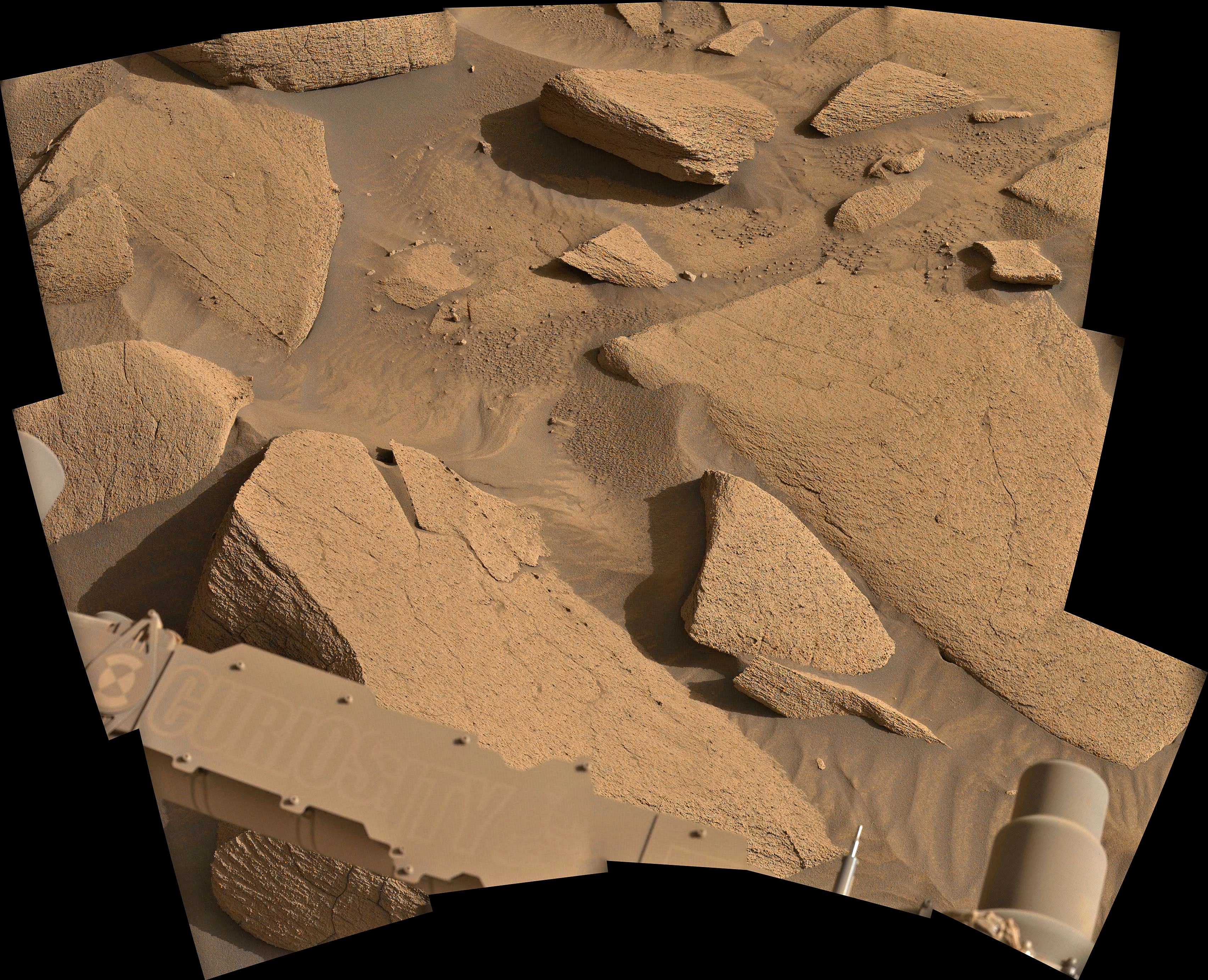
15 de-Bayered L-MastCam images assembled in MS-ICE
Credits: NASA/JPL-Caltech/MSSS/fredk
15 de-Bayered L-MastCam images assembled in MS-ICE
Credits: NASA/JPL-Caltech/MSSS/fredk
A new version of the KMZ file has just been posted by Fernando (you'll find it on his drive), it adds place names and extends the traverse to the new location after the drive on sol 4507. I used to find it better to delete the old traverse folder in GE before installing the new one :)
A new 5cm diameter abrasion patch imaged with the SHERLOC WATSON camera from different distances. We can see some chipping of the target in the second image. Hopefully the fragile rock won't cause issues if they decide to attempt to core here. The images were acquired earlier today (April 12, 2025, Sol 1473 at site 72.0). I've stretched the contrast a little to highlight the textures. Image Credits: NASA/JPL-Caltech.

UMSF moved to Discord - If you have a Discord account try this link for the 'After Party' channel
Many of the original subscribers to UMSF are active there....
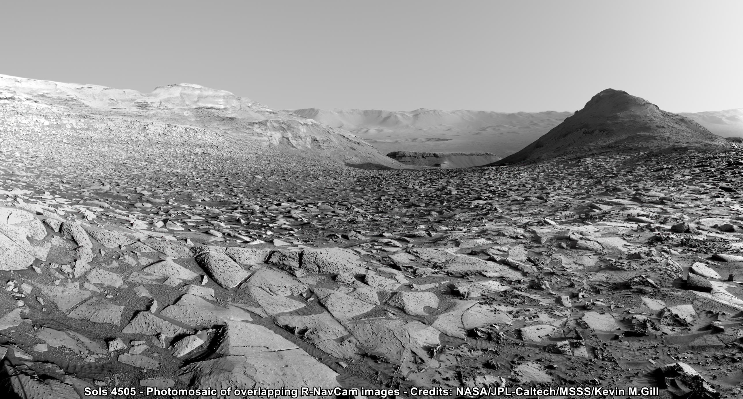
Mosaic of R-NavCam images processed by Kevin M Gill
Attached is a roughly processed / cropped post-drive L-NavCam composite image from 6 tiles, the drive data, and screen capture of the updated mission map. The traverse distance was 14.5 meters (47.5 ft) due west. Credits: NASA/JPL-Caltech/UofA.


Processing by Kevin Gill NASA/JPL-Caltech/MSSS/K.Gill
Source https://live.staticflickr.com/65535/54442214372_923410b165_o.jpg

I had no idea you could send DM's here :) But sure go ahead, I'll help in anyway you can.
Right side Mast Camera (full zoom 110mm)
NASA/JPL-Caltech/ASU/MSSS

https://lemmy.world/u/[email protected]
It's on the side of a butte to the north of the rover, see attached screen shot assembled from the navigation camera images acquired on the same sol, I've circled the target rock

This image was taken by MAST_RIGHT onboard NASA's Mars rover Curiosity on Sol 4505 (2025-04-08T17:24:44.000Z)
Credits: NASA/JPL-Caltech/MSSS/fredk

The main image is a post drive 4-tile NavCam image acquired just after local noon. Below is the drive data extracted from JPL's M2020 JSON URL

Credits: NASA/JPL-Caltech

You can find a lot more of Kevin's fantastic processing on Flickr
Full size Source:

Here you go... It's a link to his Google Drive. In the folder you'll find a PDF that requires a minor update as it still points to UMSF (now defunked) but Fernando is waiting for UMSF to be resurrected that process is in work, and once done he'll update the PDF user manual. The KMZ file in the folder is the one you open to update the map on Google Earth. The current version reflects the rover's current location. The folder also contains the high resolution map tiles to install inside Google Earth.
https://drive.google.com/drive/folders/1OJHhlAIftz_fh-CcJsG33JAOalrEHBbQ?usp=drive_link
A drive by Perseverance rover took it to site 71.696 during Sol 1468 (April 7, 2025) The attached image is one of the end-of-drive navigation camera 4-tile composite images. Credits: NASA/JPL-Caltech
I'll post the map and JSON data in the comments of this post as soon as JPL release it

Sorted - I'll gather the download links etc and send them in the next day or so :)
If you don't already have it installed, get yourself the pro version of Google Earth installed (it's free)


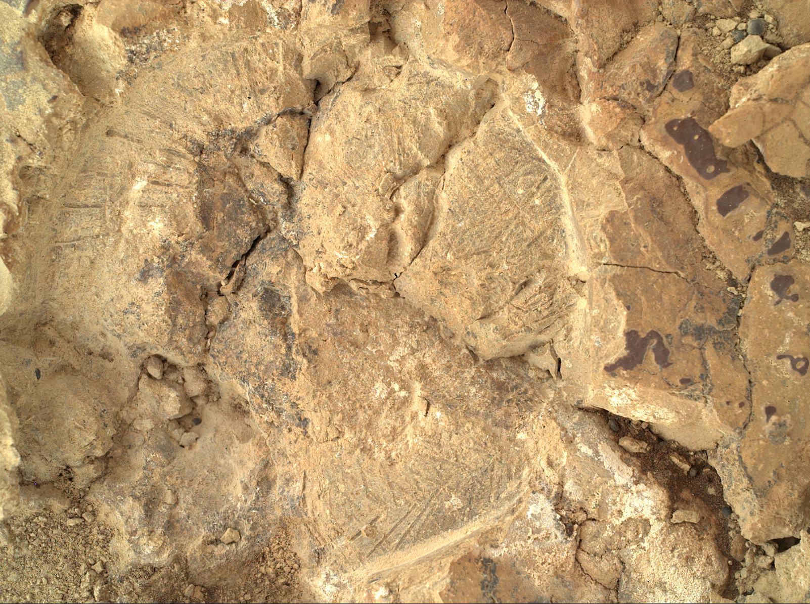
It is an imprint of the abrasion tool that grinds away the weathered surface of rocks so the chemistry of the rock can be measured with the rovers instruments