OpenStreetMap community

4612 readers
15 users here now

Everything #OpenStreetMap related is welcome: software releases, showing of your work, questions about how to tag something, as long as it has to do with OpenStreetMap or OpenStreetMap-related software.

OpenStreetMap is a map of the world, created by people like you and free to use under an open license.

Join OpenStreetMap and start mapping: https://www.openstreetmap.org/.

There are many communication channels about OSM, many organized around a certain country or region. Discover them on https://openstreetmap.community/

https://mapcomplete.org/ is an easy-to-use website to view, edit and add points (such as shops, restaurants and others)

https://learnosm.org/en/ has a lot of information for beginners too.

founded 5 years ago
MODERATORS
1
2


- I know that a particular ford openstreetmap.org/way/47302278… is impassable by cars and have tried to mark it as such however even after this change and allowing routing engines to update many still seem to use the route. (e.g. Osmand+) - Is there anything else I should have done or have I have done incorrectly that should be fixed?

3
4
5
6


Panoramax is a fully FLOSS streetview server and ecosystem. Check them out!

7
8
9
10


I use osmand, however is there a plugin or separate app that uses traffic data or weather data (road closure/accidents).

11
26
submitted 1 month ago* (last edited 1 month ago) by [email protected] to c/[email protected]


I am annoyed by komoot. Is there any suitable alternative for sharing hiking or biking trips online. Something like OSM but for tours. Ideally federated, but I would be happy with anything.

Edit:

The main feature I am looking for is finding a tour. I want to enter a location and an activity and find nice tours with gps tracks, pictures and a description.

Komoot and Outdooractive can be used as navigation and map viewing apps aswell, but I think there are enough posts about alternatives to those like Mapy.cz, Organic Maps or OSMand.

12
13


That looks really cool

14
15


Right now I create a note "so and so business operates at this address" but is there better way to do this? [Using Streetcomplete]

16


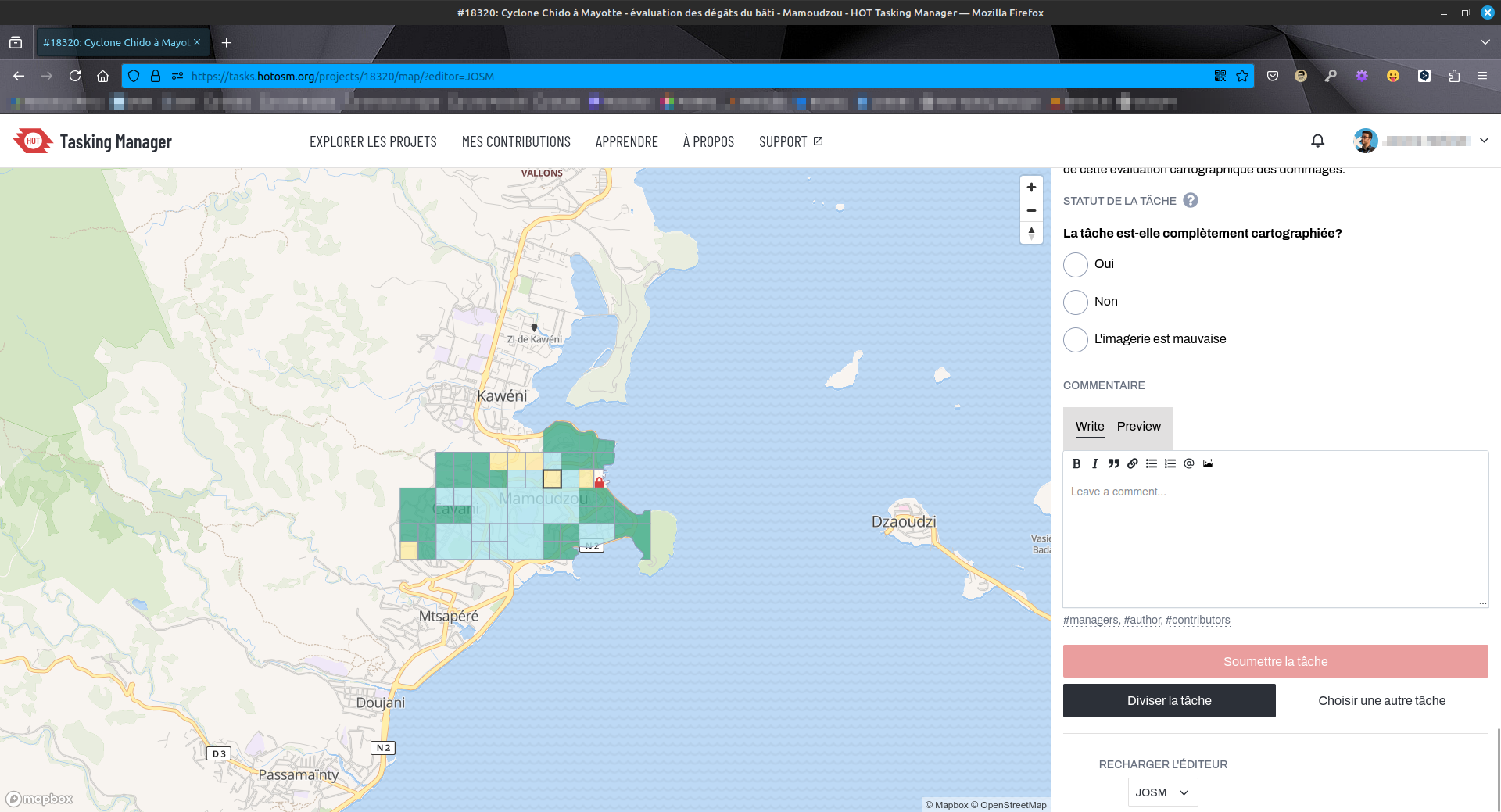
🌀 :openstreetmaps: Travaux d'évaluation des dégâts sur #Mayotte sur #OpenStreetMap via #HOTOSM. État de destruction de chaque bâtiment évalué (🟢 aucun, 🟡 minimal, 🟠 important, 🔴 complet). Outil : #JOSM. Photos post-cyclone fournies pas le #CNES #Airbus.
🔗 URL projet : https://tasks.hotosm.org/projects/18320/tasks/
👋 @[email protected] @osm_fr @[email protected]
#️⃣ #humanitarian #humanitaire #OSM #climate #climat #solidarité #logicielslibres #opensource #freesoftware #FOSS #FLOSS #cartographie #cartography #hurricane #HOTOSM

17


My partner and I love having live location sharing, it's the main feature of Google Maps that we loathe leaving behind. Is there anything in the OSM ecosystem that replicates it?

So far I found OsmAnd's tracker, which I think works by sending location updates through a Telegram backend or some such?

Is there anything else out there? Anyone else using a feature like this?

18
19


Hi,

Following the Gulf of Mexico nonsense.

Why, de facto default map, doesn't show names of lakes, seas, oceans, etc.?

20


Repo: https://github.com/ciupava/maptcha_dev

Demo: https://maptcha.crown-shy.com/

I didn't make this I just wanted to share here before I add it to my weekly urbanism roundup newsletter https://urbanismnow.com/

21
18
submitted 1 month ago* (last edited 1 month ago) by [email protected] to c/[email protected]


When mapping buildings, I'll switch between the ESRI and Bing satellite maps, since they both offer different "freshnes" and clarity, depending on the area.

However, when I use my official municipal or regional websites, they have ESRI maps that appear to be quite a bit newer.

Is the licensing different across different ESRI imagery sources, or could I use the more updated one as a guideline?

EDIT: I think I found my answer from the official OpenStreetMap Wiki:

" Esri is a corporate member of the Foundation."

~~"Esri allowed the usage of Esri World Imagery (and its variants) in OSM mapping, without restrictions and requirements. Even attribution is not legally required."~~

~~This is wonderful news! Having satellite images from only a few months ago, rather than a few years ago, is a game-changer!~~

So this might have been overly optimistic. There may be additional licensing restrictions on variants outside what's available in the OSM editor.

22


I keep seeing this in edits, but where can you view this "Lyft-owned street-level imagery"??

Even searching for it comes up with nothing.

23


I'm sure this has been asked thousands of times, but how do I view the map extracts offline? (.osm and .pbf) Is there a (native) app I can use? Can't find any clear information.

24
25


WIP

view more: next ›