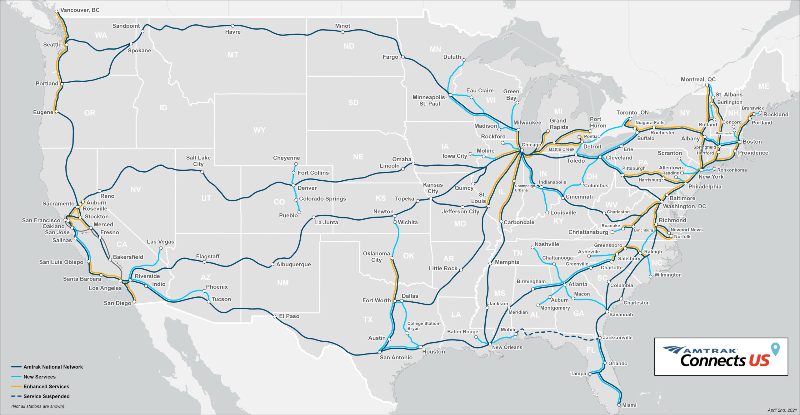
Today, from Amtrak's website:
A place to discuss problems of car centric infrastructure or how it hurts us all. Let's explore the bad world of Cars!
1. Be Civil
You may not agree on ideas, but please do not be needlessly rude or insulting to other people in this community.
2. No hate speech
Don't discriminate or disparage people on the basis of sex, gender, race, ethnicity, nationality, religion, or sexuality.
3. Don't harass people
Don't follow people you disagree with into multiple threads or into PMs to insult, disparage, or otherwise attack them. And certainly don't doxx any non-public figures.
4. Stay on topic
This community is about cars, their externalities in society, car-dependency, and solutions to these.
5. No reposts
Do not repost content that has already been posted in this community.
Moderator discretion will be used to judge reports with regard to the above rules.
In the absence of a flair system on lemmy yet, let’s try to make it easier to scan through posts by type in here by using tags:
Today, from Amtrak's website:
I'll edit and put it in the body too. Good call.
This map doesn't show all the stations.
Here is the actual current map
From
https://www.amtrak.com/content/dam/projects/dotcom/english/public/documents/Maps/Amtrak-System-Map-1018.pdf
Important to note the key in the bottom left. The green lines aren't trains, they're generally bus routes that Amtrak coordinates with.
Blame Amtrak. I got the image from their website.
That map is on the Amtrak website in an article highlighting areas of planned new development. https://media.amtrak.com/amtrak-connects-us/
Ah, my mistake. Thanks.
The European mind cannot comprehend this simple trick!
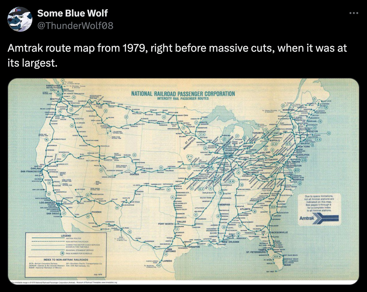
Nice, Nova Scotia exists after 1979.
So the grid is basically the same but most of the stations are gone.
The “after” pic isn’t showing all the stations.
The other difference is some routes get 2 trains a day and it probably cost $5k to go cross country
2 trains a day would be an improvement for many routes, a lot are 1 train a day or 3 trains a week.
Yeah i didnt mean to make antrak sound good. Its a laughable grid even for 1979 and to not have evolved since then while lowering frequency and increasing fares its just a joke.
I'm not sure why the current map doesn't show them, but no, the stations are not gone. I ride the Amtrak from Chicago far out west quite often, it still stops in all of the places that the old map says.